

Miaoqiang tech
#Multi-rotor #reconnaissance #UAV
#Multi-rotor #reconnaissance #UAV
Couldn't load pickup availability
MQ-MRCU0622
Technical Specifications and System Overview
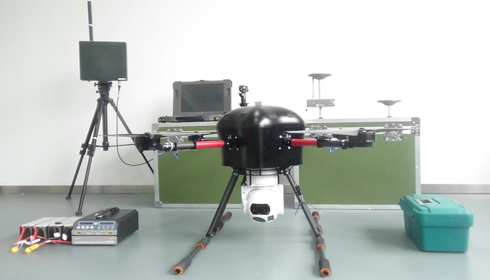
1. Hardware Architecture
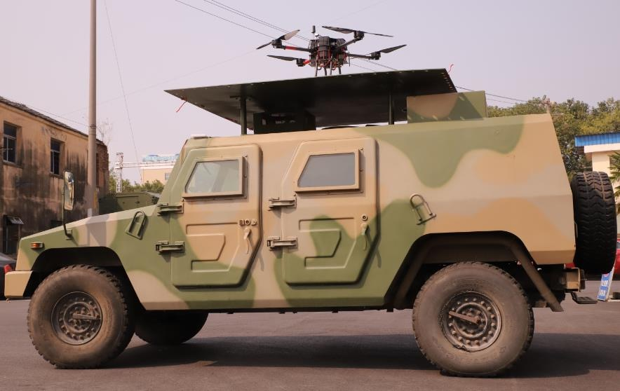
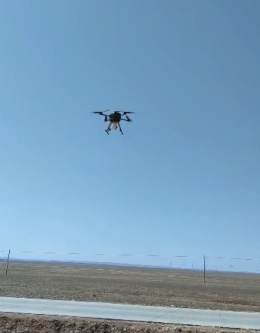
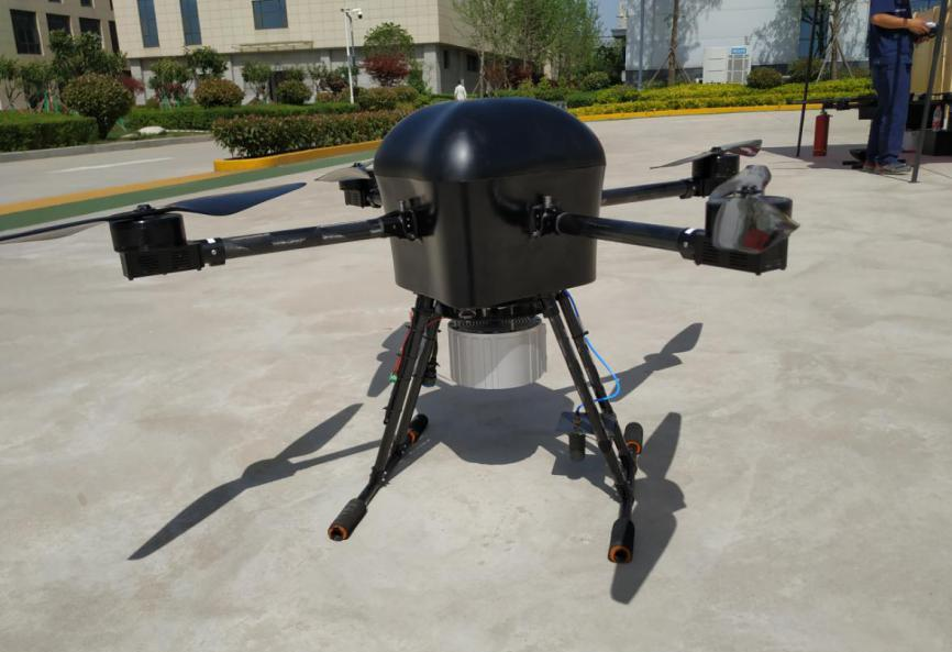
The MQ-MRCU0622 adopts a multi-rotor aerodynamic configuration, designed to deliver exceptional flight stability, precise hovering, and superior maneuverability under various environmental conditions. The airframe is constructed using lightweight, high-strength composite materials, ensuring optimal balance between endurance and payload capacity.
The system can be configured with high-definition electro-optical (EO) and infrared (IR) cameras, or a combination of specialized reconnaissance sensors such as LiDAR, thermal imaging modules, and multispectral cameras. This modular design allows flexible adaptation to a wide range of missions, from tactical surveillance to environmental mapping.
An integrated advanced flight control unit (FCU) enables both autonomous operation and manual remote control, supporting complex flight modes such as waypoint navigation, automatic takeoff and landing, and terrain-following flight. The drone’s extended-endurance power system allows long-duration reconnaissance missions with minimal downtime.
2. Communication and Data Transmission
The MQ-MRCU0622 is equipped with a 5G-enabled high-bandwidth communication system, ensuring real-time transmission of high-definition video and telemetry data over extended distances. In environments without 5G coverage, the system supports multi-channel redundancy through 4G, private LTE, or encrypted radio frequency (RF) links.
A low-latency digital video transmission system ensures continuous, high-resolution video feeds to the ground control station (GCS), enabling operators to make rapid and accurate mission decisions. Data is encrypted end-to-end, guaranteeing secure and interference-free communication in sensitive operations.
3. Application Scenarios
-
Military and Security Reconnaissance:
Designed for border patrols, battlefield intelligence gathering, and target tracking. The platform’s low noise and radar signature make it ideal for covert surveillance missions. -
Aerial Mapping and Urban Planning:
Delivers ultra-high-definition aerial imagery for infrastructure monitoring, topographic mapping, and construction planning. -
Environmental Monitoring:
Supports pollution tracking, wildlife observation, and disaster assessment with advanced sensor payloads. -
Search and Rescue Operations:
Provides aerial situational awareness during natural disasters, accidents, or emergency responses, transmitting live imagery to rescue teams in real time.
4. Technical Advantages
-
High Efficiency and Responsiveness:
The multi-rotor propulsion system provides rapid response to control inputs and maintains stability in high-wind or confined environments. -
High Reliability and Redundancy:
The flight control system integrates triple-redundant IMUs, GNSS modules, and fail-safe mechanisms, ensuring safe operation even under electronic interference or partial system failure. -
Operational Flexibility:
The modular design allows rapid deployment, payload swapping, and mission-specific configuration. It can be transported and launched within minutes, enhancing field readiness.
5. Future Development Prospects
As unmanned aerial technology continues to evolve, the MQ-MRCU0622 platform is designed with future scalability in mind. Integration of artificial intelligence (AI) and machine learning (ML) algorithms will enable advanced autonomous decision-making, object recognition, and adaptive flight path optimization.
Emerging innovations such as swarm coordination, edge computing, and energy-efficient propulsion systems will further enhance the platform’s reconnaissance accuracy, operational range, and mission efficiency—making it a vital tool for next-generation aerial intelligence and situational awareness missions.
Share